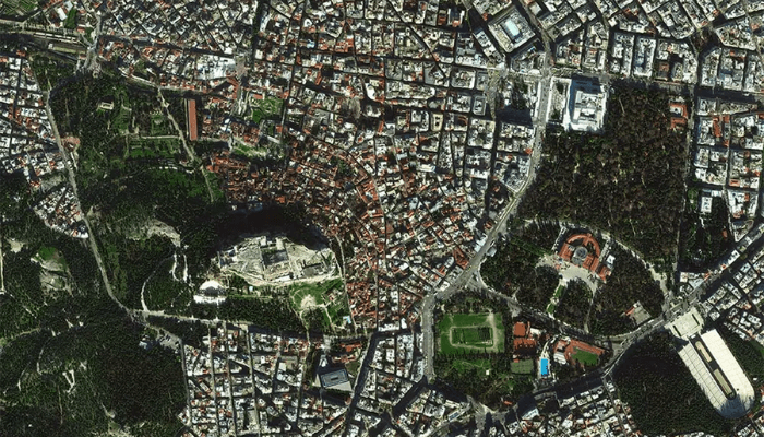
Exploring the heights: Satellite technology reveals the hidden beauty of cities
Satellite technology has been one of the most powerful tools for observation and analysis of cities around the world. With increasing urbanization and the need to monitor the growth of cities, satellite visualization has become an indispensable technique for public and private managers.
With satellite technology, it is possible to obtain high-resolution images that are updated in near real time, allowing the analysis of changes in urban areas around the world. In addition, satellite visualization can also be used to monitor air and water pollution, helping to identify areas of environmental risk.
While satellite technology is a powerful tool for analyzing cities, it is important to remember that collecting and processing this data requires significant technical and scientific understanding. In addition, ethical and privacy issues also need to be considered when using these technologies.
What is satellite?
Satellite is a term widely used in astronomy and technology to describe an object that orbits around a larger celestial body. These objects can be natural, such as the Moon, or artificial, such as satellites launched by humans for various purposes, such as Earth observation, communications, meteorology and space studies.
The use of artificial satellites has become a vital part of our daily lives. They enable long-distance communication, provide accurate images of our planet for mapping and weather forecasting purposes, and are used to study the universe and better understand our position in it.
How does a satellite work?
Satellites are complex devices that orbit the Earth and have a variety of functions, including communications, navigation, and Earth observation. They work through sophisticated systems such as solar panels to provide power, propulsion systems to maintain orbit, and sensors and instruments to collect and transmit information.

here is a list of basic steps to understand how a satellite works:
- Launch: The satellite is launched from Earth using a rocket. During launch, it is placed in a specific orbit around Earth.
- Energy: The satellite uses solar panels to collect energy from the sun and convert it into electricity to power its systems.
- Propulsion: The satellite uses propulsion systems to maintain orbit. They can use rocket engines, gyroscopes or magnetometers to maintain the correct position.
- Communication: The satellite uses communication systems to transmit information back to Earth. This includes using satellite antennas on Earth to receive satellite signals.
- Sensors and instruments: The satellite uses a variety of sensors and instruments to collect information, including cameras, infrared sensors, and spectrometers.
What is the best satellite to tune the satellite dish?
With the continuous advancement of satellite technology, choosing the best satellite dish in 2022 is a crucial issue for those looking to enjoy a high quality viewing experience. Among the various satellites available, one of the most promising is the Eutelsat 7C, which offers a set of advanced features, including a wide range of TV and radio channels in high definition.
In addition, Eutelsat 7C features wide geographic coverage, allowing users to enjoy a high-quality viewing experience across the globe. With its high-speed data transmission capability, the satellite is especially suited for use in remote areas where internet connectivity may be limited.
Which satellite for new dish?
When installing a new satellite dish, many people wonder which satellite is best suited for reception. There are several satellites available for broadcasting TV and radio channels in different regions of the world, each with its own characteristics.
Below is information about the StarOne C2 satellite in list form:
- The StarOne C2 satellite is a geostationary satellite operated by Embratel Star One, which was launched in 2008.
- It is located at an altitude of 70 thousand km above the Earth, which makes it a long-distance satellite.
- The StarOne C2 is equipped with transponders that transmit TV and radio signals throughout Latin America, including Brazil.
- It has a wide signal coverage, which means it is a good choice for those who want to receive TV channels from different countries.
- The satellite is compatible with most satellite dishes available on the market and offers a wide variety of TV and radio channels to choose from.
- The StarOne C2 is also known for its reliable and consistent signal quality, making it one of the best options available today for those wanting to receive satellite TV channels.
————————————————– ————————————————– —————

Deixe um comentário